GIS IQ Blog
Kategorien
  • Forschung
  • Hochschule
  • Schule
Themen
ArcGIS Case Studies Digitale Bildung Dozierende eduGISchat Events GeoDev KarriereMitGIS Kartografie Lehrerhandreichungen Open Data Praktikum Projekte Ressourcen Schüler Smart Campus Smart Community Sommercamps Story Map Studierende Tutorial Unterricht Wettbewerb
0
0
0
GIS IQ Blog GIS IQ Blog
GIS IQ News abonnieren
  • Schule
  • Hochschule
  • Forschung
  • Hochschule

GICHD and DDPS go on a recruitment tour for 1-year field missions as geographic information advisers for mine action

  • 27. Januar 2020
  • Katia Valenza Lyons
Total
32
Shares
32
0
0
0
0
0

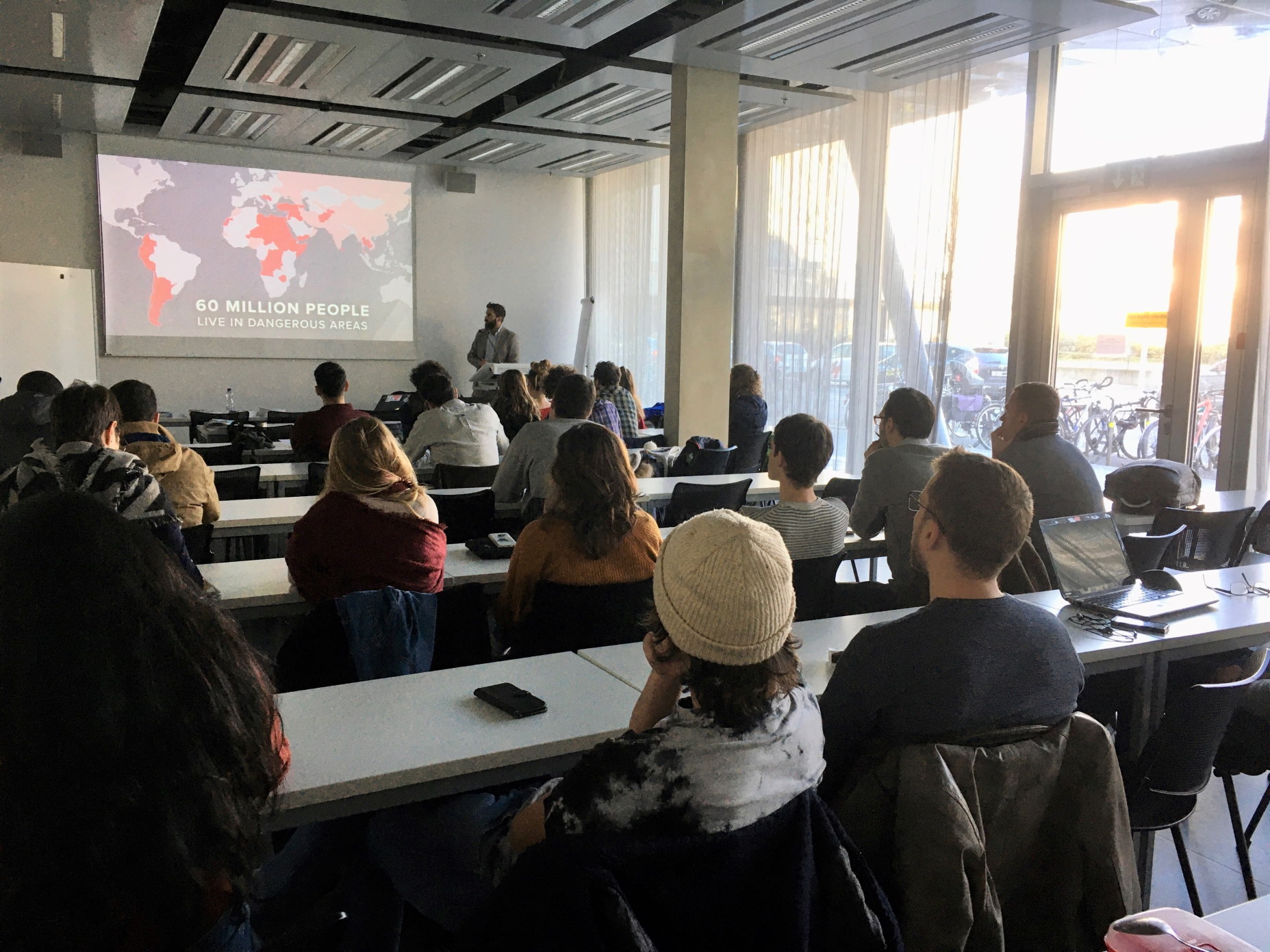
On Wednesday 15.01.2020, two representatives of the Geneva International Center for Humanitarian Demining (GICHD) and the Swiss Federal Department of Defence, Civil Protection and Sport (DDPS) came to the University of Geneva to give a presentation of the Information Management System for Mine Action (IMSMA), used in countries affected by explosive remnants of war and ammunition storages for depollution operations.

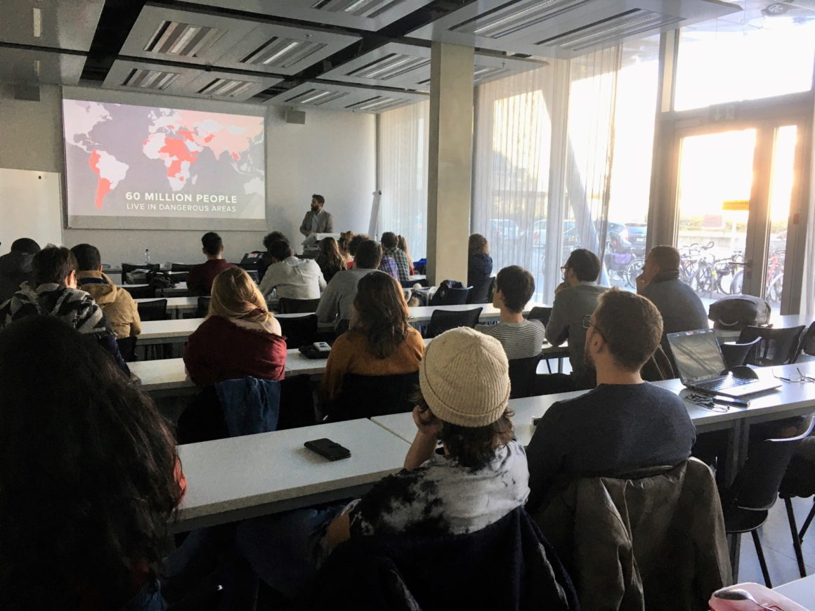
Olivier Cottray from GICHD gave an overview of the demining workflows that mostly rely on spatial analysis to help outline hazard area and define priorities for demining efforts. IMSMA is currently built on ArcGIS components with desktop, online and field applications. The DDPS presented a program held by the Swiss Confederation and the United Nations Mine Action Service to enroll qualified Swiss students, graduates or information management professionals as IMSMA advisors for 1-year field missions (civilian deployment; extension possible).

The meeting was very successful with a room full of interested students asking questions. Similar presentations will be organized in other Swiss universities as opportunities arise. To know more about IMSMA, the recording of GICHD’s presentation at the 2019 Esri User Conference is available online:

YouTube

Mit dem Laden des Videos akzeptieren Sie die Datenschutzerklärung von YouTube.
Mehr erfahren

Video laden

If you are a Swiss student, graduate or experienced information management professional with advanced training on ArcGIS, and you meet the enrollment criteria as listed in the attached factsheet, feel free to contact Mr. Cottray from GICHD or the DDPS ( general information, recruiting)  to express your interest.

Total
32
Shares
Share 32
Tweet 0
Pin it 0
Katia Valenza Lyons

I started my studies in Geology at University of Lausanne and Geneva where I discovered all aspects of Earth Sciences. I was especially interested in the mineralogy of ore deposits which led me to study barite vein deposits in the Western Jebilet in Morocco. After experimenting research and applied geology, I became interested in GIS and worked for a year as GIS project leader at Etat de Vaud. I then decided to specialize in GIS at University College London where I followed an MSc program. Back in Switzerland in 2004, I was hired as Account Manager by Esri, focusing on the Education, Nonprofit and Industry markets. Since August 2019, I am Program Manager mostly for the Nonprofits, helping them take advantage of Geographic Intelligence in support of their missions.

Voriger Artikel
  • Forschung
  • Hochschule
  • Schule

Tipp für die Kartenerstellung: Schöne Schattierungen erstellen

  • 15. Januar 2020
  • Team Education
Weiterlesen
Nächster Artikel
  • Hochschule

Esri Konferenz 2020: Das sind die Specials für Studierende

  • 3. Februar 2020
  • Fabian von Bechen
Weiterlesen
Auch interessant
Python API Prakitkum
Weiterlesen
  • Hochschule

Praktikum bei Esri: ArcGIS Online Nutzerverwaltung mit der ArcGIS API for Python

  • Team Education
  • 8. Juni 2022
Weiterlesen
  • Hochschule

Kompendium zum Einstieg in GIS

  • Team Education
  • 3. Juni 2022
Weiterlesen
  • Forschung
  • Hochschule

ArcGIS Pro aus ArcGIS Online herunterladen

  • Stefan Graf
  • 18. Mai 2022
Weiterlesen
  • Hochschule

Podcast #KarrieremitGIS: Mountainbike, Geodaten-Management und SDGs

  • Fabian von Bechen
  • 20. April 2022
Weiterlesen
  • Hochschule

Lerne ArcGIS auf niederländische Art

  • Stefan Graf
  • 7. April 2022
Weiterlesen
  • Hochschule

Hochschul-Lehre mit ArcGIS

  • Team Education
  • 23. März 2022
Weiterlesen
  • Hochschule

Erfolgreich studieren mit ArcGIS

  • Team Education
  • 22. März 2022
Weiterlesen
  • Hochschule

NGOs: Mehrwert für die Welt dank GIS

  • Katia Valenza Lyons
  • 16. März 2022
GIS IQ Blog
  • Über uns
  • Impressum
  • Datenschutz
Lernen. Forschen. Entwickeln. Mit GeoIntelligenz!

Gib dein Suchwort ein und drücke Enter.