The development of sustainable regions requires an understanding of the land systems that supply the needs of nature and people. At the Open Science Meeting in Bern the Spanish land-use scientist and post-doc María Piquer-Rodríguez explains why the isolated view of disciplines does not correspond to the idea of sustainability – and why a holistic approach pays off. An interview.
María, at end of April the world’s leading scientists come together at the 4th Open Science Meeting of the Global Land Programme to talk about pathways to a sustainable future. You’re one of these leading scientists. What is your professional approach to this topic?
I have always found it very important to understand how the use of the land, often driven by economic profitability or land rights, may impact the environment and the human wellbeing.
An example: As a researcher at the University of Tucuman in Argentina I have been involved in several projects for the Gran Chaco of South America – a dry tropical forest with high deforestation rates mostly due to the expansion of soybean production and cattle ranching activities. I have worked in an array of activities in this diverse region, from understanding drivers of land-uses, characterizing land systems and developing scenarios of future land-uses under conservation or economic policies.
I think that without having in mind the nexus of all these different disciplines and approaches, it is complicated to stimulate the sustainability of this region.
So, an interdisciplinary approach is essential for a sustainable use of the land?
Yes. In my work I try to keep a holistic view of the potential interactions in socio-environmental systems. We cannot understand isolated systems because the impacts of human actions are manifold. I believe that only under an integrative view we can move towards a fairer future for the population. Interdisciplinarity is the key for sustainability.
One of your contributions to the Open Science Meeting is a round table dedicated to the question of how socio-ecological land systems in South America can be mapped digitally. Why is data so important for your concept of sustainability?
I believe that there is a general trend now in the land-use and conservation sciences that points at integrating disciplines. Data help us to understand the variety of systems present in a region and to estimate the potential difficulties that managers or politicians can face when planning for sustainability.
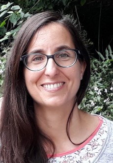
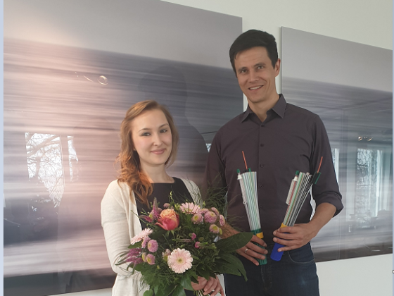
María Piquer-Rodríguez is interested in understanding the forces of land-use change in agricultural frontiers (especially in South America) and how economic, conservation, or zoning policies can influence them now or in the future. She participates at the 4th Open Science Meeting of the Global Land Programme in Bern, Switzerland, April 24 – 26. Website: https://mariapiquer.github.io/
What kind of data are you mapping exactly?
Let me first say that this a huge collaborative project led by our Institute (Institute of Regional Ecology-UNT) and Ms. Lucía Zarbá. In this project more than 20 scientists from the Americas work together. I find this fascinating!
We include a variety of factors that cover bio-physical properties of the Earth such as climate or elevation, social factors such as population density or governance levels and economic factors such as the level of accessibility of regions by roads or to ports. We also include variables of land-use and land cover and document where croplands, grasslands, forests or mines are located. Furthermore, we add some historic variables of use that characterize since when a region has been used for human activities – framed in the anthromes context.
Could you tell us how exactly mapping land systems contributes to sustainable development?
Let me give you an example: One of my contributions to the OSM GLP meeting is an analysis of symmetries of commodity production regions for soybean in South America. We use national ecoregions to characterize typologies of existing land systems.
Since we compare the national section of an ecoregion and the factors that determine regional differences, we can better understand systems and their differences. With this information we can suggest potential causes of tensions between regions.
Thanks to our analysis, we can explain why soybean producing regions of South America that are far away have similar functioning structures in terms of accessibility, population, fire regimes or their network of protected areas. We can thus discuss potential socio-environmental impacts that can occur in the future in distal regions that share land systems.
What technology do you use to map this data?
I use GIS to explore data and visualize and map results. When you work with spatial data that comes from different sources, there are always issues with the projection of the data and GIS help to visualize potential problems with the data in a first diagnostic.
After crunching the data in R, I go back to GIS to make sure that results make sense. Then I generate attractive and informative maps.
Thanks to The Esri Early Career and Global South Scientist Grant you come to Bern. How important is the international academic exchange for your work?
Very important. This grant as well as the GLP Travel Grant help me to benefit from an academic exchange of high level. It is a fantastic side of academia: You learn a lot, you exchange ideas and develop new ones with people you did not know.
These types of grants for fellows that cannot afford research and conference visits are fundamental. I wish there were more grants like this as well as more access to commercial GIS software for students and researchers.
Das Interview führte: Denis Heuring
Mehr Informationen über die Esri Grants.
Lernen, Forschen, Entwickeln: GIS für Schulen und Universitäten in Deutschland und der Schweiz.
GIS for a Sustainable World Conference (30. April – 2. Mai 2019)


